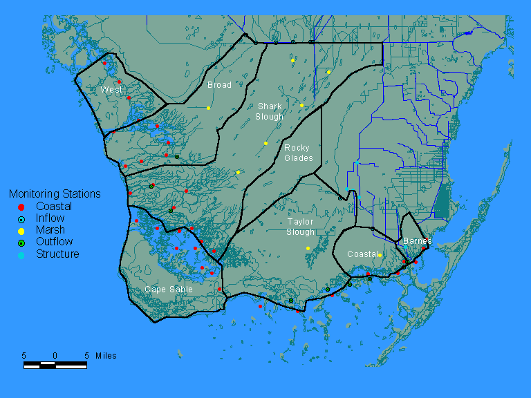
Estimation of Inputs to Florida BayComparison of Observed & Predicted Inflows from Florida MainlandIntroduction | Measured Flows | Taylor Slough | Coastal Basin | Total Flows | Correlations with Salinity This section compares observed and predicted inflows to the Florida Bay region from the Florida Bay mainland for 1996-1997. Methods for predicting inflows are described in a separate section. Observed values are based upon measurements made by the U.S. Geological Survey. Station locations are shown on the attached map (symbols labeled as "outflow stations"). Periods of record and links to project descriptions are provided below:
Flow data from the Northeast Florida Bay sites are available in provisional form. Flow data from the Southwest Coastal sites are not yet available (stage measurements and water quality only). Given the diffuse nature of the inflows, these specific monitoring points may not reflect all of the freshwater inflows from the Mainland. Measured flows were available in yearly data files containing 15-minute unit values. Monthly flow volumes have been computed for each station using the following procedure:
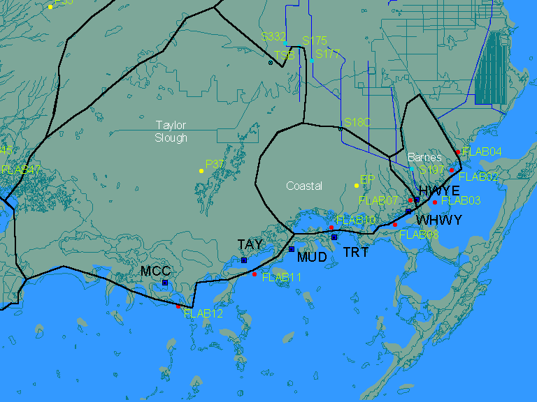
Negative flow values were common at most sites. These were treated the same as positive flows. Results estimate the net outflow for each station and month. The following analysis focuses on inflows to Northeast Florida Bay from the Taylor Slough and Coastal Basins. The following map shows basin boundaries, flow stations, and water quality stations:
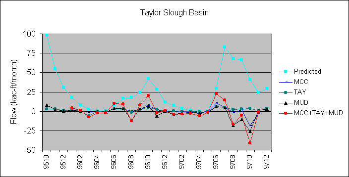
Results for inflows to the Southwest Coast will be considered when observed flows are available. Flow monitoring stations in the Taylor Slough basin included the Taylor River, McCormick Creek, and Mud Creek. The following figure shows the observed monthly flow for each station, the total observed flow, and the total predicted outflow:
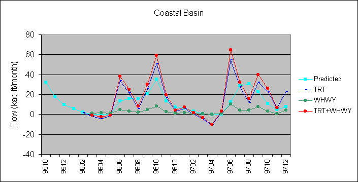
Flow monitoring stations in the Coastal Basin included Trout River, and West Highway Creek. Measured flows for East Highway Creek and Jewfish Creek are not currently available. The following figure shows the observed monthly flow for each station, the total observed flow, and the total predicted outflow:
Comparison of Observed & Predicted Total Flows The following table lists observed and predicted flows for the February 1996-November 1997 period when measured flows were reported at each station:
The total predicted flow exceeds the total measured flow by more than a factor of two. The large difference is attributed primarily to the Taylor Slough basin. The differences may partially reflect outflows from the basin occurring at locations which were not gauged. Differences could also be attributed to the fact that measured flows reflect surface values only, whereas predicted flows reflect the sum of surface and groundwater discharges. The provisional nature of the observed flow data may also be a factor. The following table lists product-moment correlation coefficients between monthly-average salinity values measured by FIU at coastal stations and the monthly flows plotted above:
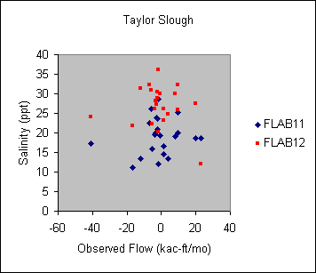
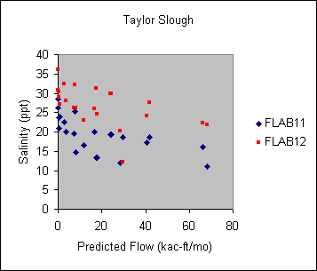
Monthly mean salinity values at stations FLAB11 and FLAB12 are plotted against observed and predicted outflows from Taylor Slough below:
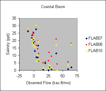
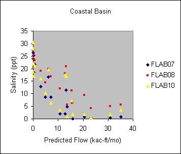
Monthly mean salinity values at stations FLAB07, FLAB08 and FLAB10 are plotted against observed and predicted outflows from the Coastal Basin below:
In each case, salinity values are more strongly correlated with predicted flows than with the sum of measured outflows in each basin. This supports the use of predicted flows in preliminary calibration of the water quality model. Possible adjustments to the predicted basin outflows based upon the above comparisions should be considered in Phase II of this project. http://www.shore.net/~wwwalker/flabay/obsflow.htm Updated: 03/30/02 |
|||||||||||||||||||||||||||||||||||||||||||||||||||||||||||||||||||||||||||||||||||||||||||||||||||||||||||||||||||||||||||||||||||||||||||||||||||||||||||||||||||||||||||||||||||||||||||||||||||||||||||||||||||