|
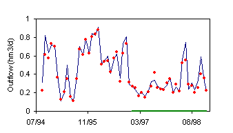
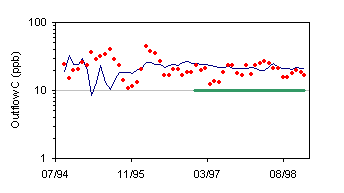
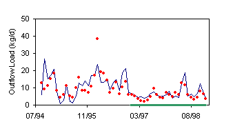
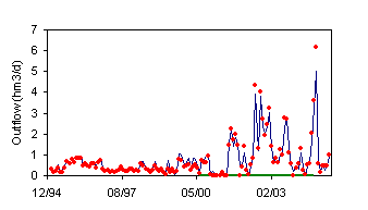
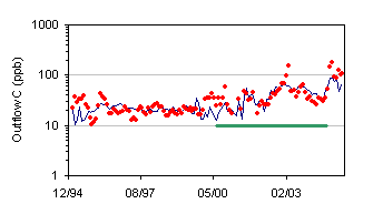
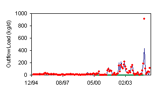
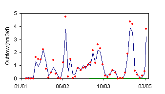
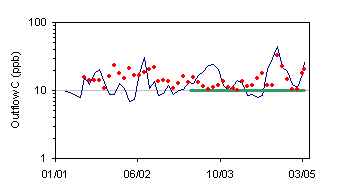
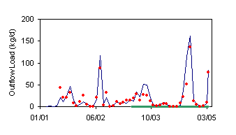
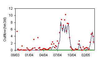
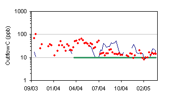
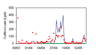
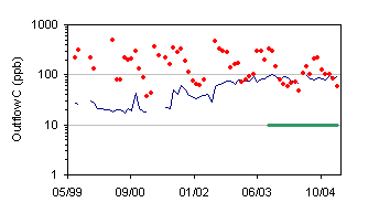
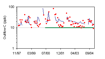
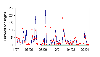
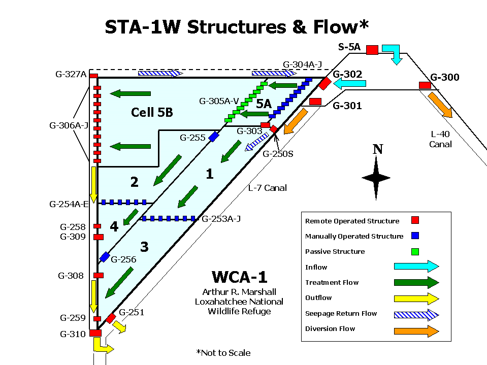
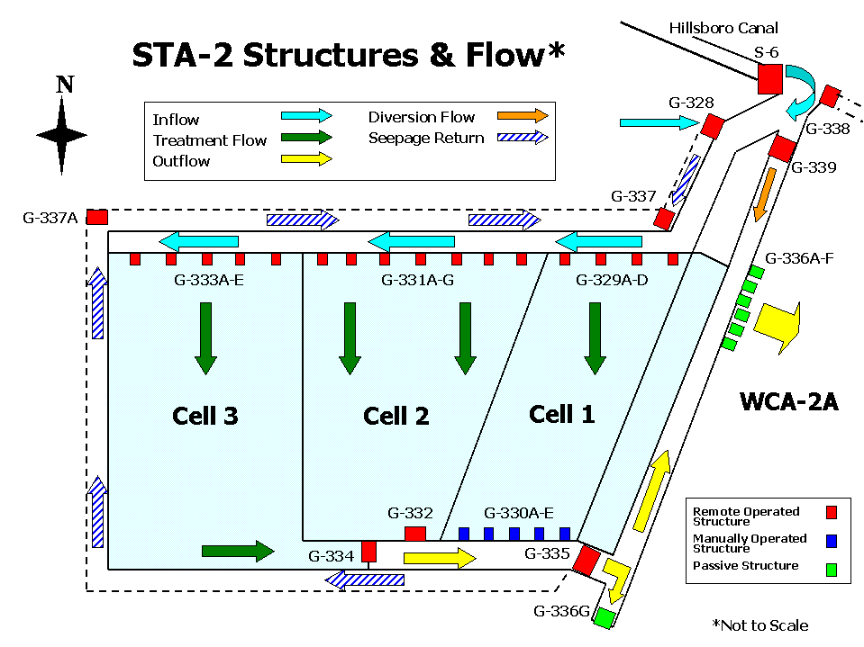
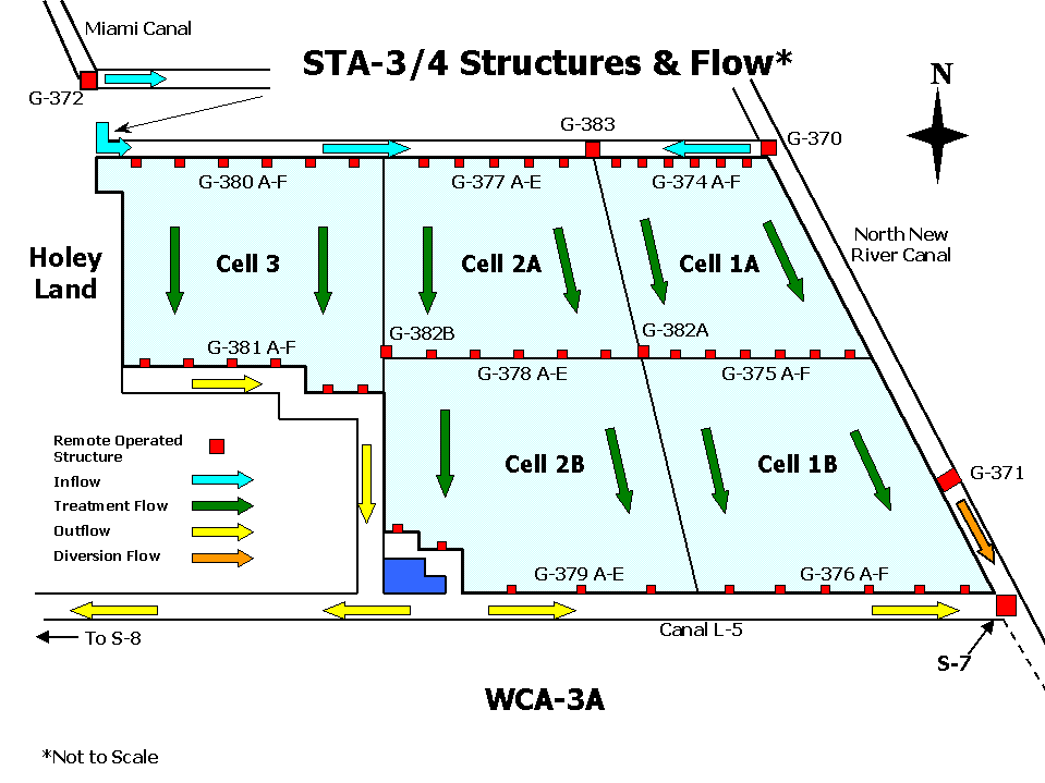
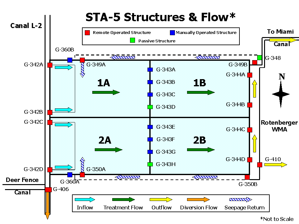
DMSTA2 Simulation of Combined STA Outflows Each STA is represented as a network of cells operating in parallel and/or series. The simulations are driven by measured inflow volumes and loads to each flow path. Each cell is modeled using the default calibration for its vegetation type (Emergent, Preexistent Wetland, or SAV). Hydraulic parameters are calibrated to each cell. Seepage recycle is treated as external inflow. Outflows from each flow path are combined to produce the results below. Lines are simulated 30-day-averages. Red symbols are observed values.
05/31/2005 |
||||||||||||||||||||||||||||||||||||

